mooseflyer
Expert
Cool, congrats. Like I said, the learning curve can be a bit steep, but once you get the hang of it I think you'll like it. The only real website that I've found is www.oruxmaps.com , where there is a link to a discussion forum. Mostly I just learned by reading the manual and playing with it though. And I'm still learning.
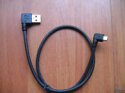
I haven't had issue with the micro-usb's durability, and I move the Nexus around quite a bit since it gets used in the car also. I accidentally took the tablet out of the mount before unplugging it once (it was dark in the car). I bent the usb cable's plug, but didn't damage the tablet at all. I bought a 90 degree usb cable like the one in the picture, just so it looks a little cleaner while on the snowmobile, but it may help with durability too since it doesn't stick out as far as a straight cable.
If you have questions, feel free to post them or send me a PM and I'll do my best to answer.
Attachments
Grimm
TY 4 Stroke God
After giving it a go this weekend, the Nexus 7 combined with Oruxmaps performed admirably! I must say that I am impressed with it's tracking ablility.
I transferred my Garmin Topo image (no work involved at all) plus my collected gpx files into the tablet and it worked very well. The issue I have using the Topo image from Garmin is that it supplies all info, including altitude, etc., at all times and they can't be removed as you zoom out. I think I'm going to start compiling a nice clean map from Openstreet maps and go from there though.
I transferred my Garmin Topo image (no work involved at all) plus my collected gpx files into the tablet and it worked very well. The issue I have using the Topo image from Garmin is that it supplies all info, including altitude, etc., at all times and they can't be removed as you zoom out. I think I'm going to start compiling a nice clean map from Openstreet maps and go from there though.
Grimm
TY 4 Stroke God
In case anyone is interested in downloading some maps for their Android device, try this site: http://www.openandromaps.org/en/downloads
It will save you a lot of time trying to compile your own custom maps.
It will save you a lot of time trying to compile your own custom maps.
MidwestMike
Extreme
- Joined
- Sep 14, 2012
- Messages
- 100
- Location
- Oak Lawn, IL Ride in SW Michigan
- Country
- USA
- Snowmobile
- Vector
I've played with the droids and offline maps for a few years, I've gotten close but never quite there.
I've played with Oruxmaps, My Tracks to build my own, and plenty of other options.
(At this point I've got all my trails "built" already with My Tracks..)
This year I bought a 7 inch tablet thinking I had it worked out, with saving Google maps offline and then using the coordinates from Michigan's DNR site. Google now changed their app to prevent saving offline, but you can go back a version to get around that.
The easiest start for just navigating is Oruxmaps, but what are the other best options for getting a map on the device? I'll look at http://www.openandromaps.org when I can (the site seems to have an issue at the moment) or Garmin Topo? The idea of riding on cleavage does sound interesting, but I would also like to find some gas stations and food once in a while.")
If you have a connection, Polaris's setup, or Google Maps with My Tracks works fine, but I want a truly offline option.
Thanks for any additinal input here.
I've played with Oruxmaps, My Tracks to build my own, and plenty of other options.
(At this point I've got all my trails "built" already with My Tracks..)
This year I bought a 7 inch tablet thinking I had it worked out, with saving Google maps offline and then using the coordinates from Michigan's DNR site. Google now changed their app to prevent saving offline, but you can go back a version to get around that.
The easiest start for just navigating is Oruxmaps, but what are the other best options for getting a map on the device? I'll look at http://www.openandromaps.org when I can (the site seems to have an issue at the moment) or Garmin Topo? The idea of riding on cleavage does sound interesting, but I would also like to find some gas stations and food once in a while.
If you have a connection, Polaris's setup, or Google Maps with My Tracks works fine, but I want a truly offline option.
Thanks for any additinal input here.
mooseflyer
Expert
Hmmm, I didn't realize Google won't allow downloads any longer. I have the maps I need already installed, so I haven't played around with it in awhile. So you're saying using the Oruxmaps program itself you can't download Google maps using the mapmaker feature? If so, that's a major drawback. But if there's a workaround, as you say, then that's great. Wouldn't that workaround give you the offline option you want?
I use Garmin's Basecamp software to manage most of my tracks/routes and maps when at home, then transfer them to/from Oruxmaps. Perhaps you already have Basecamp, but if not, you can find it for free with a little bit of effort online (or it's older version called Mapsource). I have a number of maps installed, but the two I use most often are a topo map and another map called 'great lakes trails'. I think I downloaded them both from www.gpsfiledepot.com
I did find one limitation to using a capacitance screen tablet this year that I hadn't previously discovered - moisture. This year there was so much ultra light powder it was flying all over everything when riding off trail. (the high temp had not been above freezing for almost 3 months). The powder would collect on the screen, melt in the sun, and create havoc with the touch screen. I'd have to stop and wipe it off every so often. If it were just snow - no problem, blow/wipe it off and go. It was the sunny afternoons when the snow melted to water on the screen that presented an issue.
dab102999
Expert
Lots of good advice. I have had 2 different garmins give up on me and when I was looking to replace someone told me about polaristrailmap app on my phone. I really like it and everywhere I get signal I get tracking and where I dont get signal I still have map...just an option for you also.
Grimm
TY 4 Stroke God
After using the Nexus for a couple of months, I have a few pros and cons using it as a GPS.
Pros:
- large size
- accurate
- plenty of user options and menus for customization
Cons:
- buggy if the screen gets wet...can't use gloves
- micro usb port is flimsy and broke already. A quick search on Google showed I'm not the only one...$70 fix.
- battery life...even plugged into 12v outlet, power diminished throughout the day. Shut off on my on colder (15 degree) days.
- poor back lighting...barely visible on bright days.
- difficulty level installing your own maps
- not waterproof...so I can't say it will last that long being used outside in the winter.
It was a good alternative/experiment, but the Garmin Montana I have is going back on my sled.
Similar threads
- Replies
- 16
- Views
- 895